Tide Gauge Records
What is the best sea level reference along the coasts?
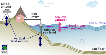
Tide gauges (mareographs) record the height of the water level with respect to a local height reference, but when differences are made to an epoch time, changes in sea level can be measured very accurately. Water level changes inferred from tide gauge registrations are relative changes as they reflect the superposition of absolute water level changes and local or regional vertical movements affecting the mareographs. To obtain absolute sea level changes from tide gauge records, they have to be corrected by vertical land motions. The vertical land motions are determined using repeated or continuous GNSS positioning.
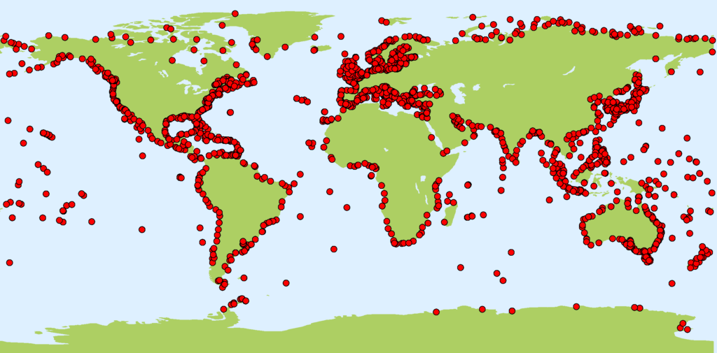
Averaging tide gauge records over long time periods eliminates most of time dependent variations. The accuracy of the mean monthly and annual values is better than 1 cm. The time series analysis of tide gauge records provides insights in climate change effects, decadal climate variability, tides, storm surges, meltwater inflow, tsunamis, and other coastal processes. These data are also useful to detect errors or drifts in satellite altimetry and to validate ocean models. In tectonically active area (like island arcs), historical tide gauge records are regarded as a source of information on long-term secular vertical movements (and sometimes co-seismic uplifts) useful for studying crustal movements during the period before space Geodesy. The Permanent Service for Mean Sea Level (PSMSL) is responsible for the collection, publication, analysis, and interpretation of sea level data from a global network of tide gauges with more than 2000 stations. PSMSL provides:
- Raw monthly and annual mean values (as delivered by the tide gauge station managers)
- Monthly and annual mean values with revised local reference (raw values referred to a common vertical reference level)
- Mean sea level trends (linear and seasonal components inferred from long time series)
- Mean sea level anomalies (difference between the revised annual mean values and the long-term annual mean)
- Global sea level reconstructions (prediction of historical data)
PSMSL is also a main player of the Global Sea Level Observing System (GLOSS), which was established by the Intergovernmental Oceanographic Commission (IOC) of UNESCO in 1985 to implement a high-quality network for the in-situ sea level monitoring.
In addition to the PSMSL data, different research institutes, universities, or national hydrographic or oceanographic agencies provide daily, hourly or higher frequency tide gauge data.
The determination of precise vertical land motions at tide gauge locations using GNSS positioning is coordinated by the working group Tide Gauge Benchmark Monitoring (TIGA) of the International GNSS Service (IGS). A complete catalogue of GNSS stations co-located with tide gauges, including in-situ sea level variations and vertical land motion trends are available at the Système d’Observation du Niveau des Eaux Littorales (SONEL). SONEL acts a primary data centre of TIGA and GLOSS. Tide gauge records also play a central role in the realisation of the zero-height surface of the existing height systems. Traditionally, it was assumed that the geoid coincides with the mean sea level and it was realised by the mean sea level derived from tide gauge records over a certain time interval. Due to the effects of the ocean surface topography and the mean sea level anomalies, these local reference surfaces may present deviations up to 2 m.


