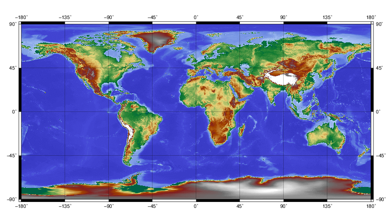
Digital Elevation Model
DEM
How can the Earth’s surface be represented?
Digital Elevation Models is a generic term to indicate the discrete representation of the surface of the Earth using points generally placed on a regular grid. For each point its position is known in a chosen reference frame and represented through a chosen coordinate system (horizontal coordinates: geographic (latitude, longitude) or cartographic (East, North); elevation (heights or depths): orthometric with respect to a chosen geoid model or ellipsoidal.
DEMs can be obtained, among others, by conventional ground topographic surveys, global navigation satellite system positioning, mapping techniques (photogrammetry), laser altimetry, satellite radar altimetry, synthetic aperture radar techniques (interferometry and radargrammetry), echo sounding, airborne optical sensing of bathymetry, ice penetrating radio-echo sounding, or by digitising of topography contours.
At present, DEMs are mostly inferred from remote sensing techniques; therefore, they natively include all objects located on the Earth’s surface, like vegetation, ice covers, buildings, infrastructures and generally all man-made objects. These DEMs are referred as Digital Surface Models (DSMs); in contrast to DSMs, Digital Terrain Models (DTMs) represent the bare topographical surface of the ground, and they are derived from DSMs through proper filtering.
Digital Terrain Model (DTM)
The concept of DTM is not only limited to Earth’s visible terrain surface. It also finds application in bathymetry (digital bathymetry models describing the geometry of the sea floor), polar geodesy (digital bedrock models to describe the rock below the ice sheets), and planetary sciences (digital elevation models of the planetary surfaces).
DTMs are usually provided in terms of regularly spaced grids which allow simple data handling, manipulation, and storage. Most recently, DTMs used in Geodesy are also given in terms of surface spherical harmonic coefficients computed from a high-resolution 2D grid. In this case, DTM heights are obtained through series expansion of the coefficients. Currently, those spherical harmonic DTM representations reach spatial resolutions of about 2 km, equivalent to harmonic degree 10,800.
The International Digital Elevation Model Service (IDEMS), which is an IAG Service within the IGFS (International Gravity Field Service), provides a focus for distribution of data and information about DEMs, spherical-harmonic models of Earth’s global topography, lunar and planetary DEMs, relevant software, and related datasets.
Topography gravity field models representing the gravitational potential generated by the attraction of the Earth’s topographic masses are available at the International Centre for Global Earth Models (ICGEM).


