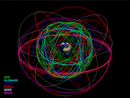
GNSS Satellite
Orbits and Clocks
How positioning benefits from precise satellite orbits and clocks?
GNSS satellite orbits provide the basis for precise positioning applications using global navigation satellite systems (GNSS) like GPS, GLONASS, Galileo, and BeiDou as well as regional navigation satellite systems like QZSS and IRNSS. GNSS contributes in innumerable ways to the functioning of a modern society. Besides the broad spectrum of positioning and navigation applications, GNSS observations are essential for Earth system studies and they provide insights into a number of critical areas that impact human society. These range from understanding earthquake processes, assessment of geohazards to monitoring the effects of climate change.
The analysis centers (ACs) of the International GNSS Service (IGS) compute three product lines of GNSS satellite orbits differing in latency and accuracy (ultra-rapid, rapid and final products). The individual AC orbits are combined by the IGS analysis center coordinator to the official IGS products that are more robust and precise compared to the individual products. In addition to the operational products, reprocessed products are available to provide highest accuracy and consistency over long time periods.
As the orbits are aligned to the International Terrestrial Reference Frame, they allow for a convenient access to the ITRF for the users of these products. Together with precise satellite clocks, the IGS orbits allow for a precise point positioning (PPP) for single stations with a precision on the several millimeter level. PPP is also applicable to moving GNSS receivers and GNSS receivers on satellites in, e.g., low Earth orbit. The IGS satellites clocks refer to a pair of dedicated code reference signals. If the user utilizes other signals, differential code biases (DCBs) have to be applied to account for systematic differences between the individual signals.


