WHY GGOS
The Earth is a Restless Planet
With its atmosphere, hydrosphere (oceans and continental water), cryosphere (ice covers), pedosphere (land surfaces) and its interior (lithosphere, lower mantle and core) Earth is subject to a large variety of dynamic processes operating on a wide range of spatial and temporal scales, and driven by large interior as well as exterior forces. Many areas of the Earth surface are vulnerable to natural hazards caused by dynamic processes in the solid Earth, the atmosphere, and the hydrosphere.
Earthquakes, tsunamis, volcano eruptions, surface deformations, landslides, deglaciation, sea level rise, floods, desertification, storms, storm surges, global warming and many more are typical and well-known phenomena that are expressions of the dynamics of our restless planet. Global change processes, whether natural or man-made, affect the equilibrium of the System Earth, and with this our lives and the lives of future generations. Living on a restless planet with finite resources and a limited capacity to accommodate the impact of increasingly powerful anthropogenic effects requires careful governance. Decisions made today will determine the well-being of future generations. GGOS seeks to fortify informed, Earth observations-based decision making.
To minimize the anthropogenic impact on the System Earth and to preserve a living environment and resources for future generations, a better understanding of global change phenomena is required.
This is only possible if our studies, models, predictions, and political decisions are based on comprehensive observations of the System Earth. Observations of the System Earth are not only necessary for the scientific understanding of the Earth. They are fundamental for many social areas ranging from disaster prevention and mitigation, the provision of resources such as energy, water and food, gaining and understanding climate change, the protection of the biosphere, the environment and human health, to the building and management of a prosperous society worldwide.
Need for a Coordinated and Sustained Earth Observation
Recognizing the urgent need for a coordinated and sustained program of Earth observation, the recent Group on Earth Observations Summits have tasked the intergovernmental Group on Earth Observations (GEO) with implementing the geodetic component of the Global Earth Observation System of Systems (GEOSS). GEOSS is a set of coordinated, independent Earth observation, information and processing systems that interact and provide access to diverse information for a broad range of users in both public and private sectors. GEOSS links these systems to strengthen the monitoring of the state of the Earth.
This ‘system of systems’, through its GEOSS Platform (former GCI), proactively links together existing and planned observing systems around the world and support the need for the development of new systems where gaps currently exist. It will promote common technical standards so that data from the thousands of different instruments can be combined into coherent data sets.
By contributing to GEO and GEOSS, GGOS provides geodetic data which, when combined with other Earth observations, can be translated into support for political decision-making. The main objective is to provide open, timely, and reliable Earth observation data to facilitate the development of policies that address societal challenges. Thus, GEOSS is essential to implement the Sustainable Development Goals (SDGs) of the United Nations (UN), the Sendai Framework for Disaster Risk Reduction, and the UN Framework Convention on Climate Change.
How Geodesy can Contribute?
Geodesy is the science of determining and representing the shape of the Earth, its gravity field and its rotation as a function of time. A core element to reach this goal are stable and consistent geodetic reference frames, which provide the fundamental layer for the determination of time-dependent coordinates of points or objects, and for describing the motion of the Earth in space. Traditionally, geodetic reference frames have been used for surveying, mapping, and space-based positioning and navigation. With modern instrumentation and analytical techniques, Geodesy is now capable of detecting time variations ranging from large and secular scales to very small and transient deformations with increasing spatial and temporal resolution, high accuracy, and decreasing latency.
Space Geodetic Positioning Methods
For example, space geodetic positioning methods (Very Long Baseline Interferometry VLBI, Satellite Laser Ranging SLR, Global Navigation Satellite Systems GNSS, Doppler Orbitography and Radiopositioning Integrated by Satellite DORIS) allow determining the positions and trajectories of points on the Earth’s surface with a millimeter-level accuracy. By analyzing these parameters, it is possible to
- monitor surface deformations associated with natural hazards (volcano eruptions, seismic effects, landslides, subsidence, etc.);
- model tectonic features (plate motion, surface deformation, slow-slip interactions, etc.) including vertical movements associated with mountain building or global isostatic adjustment (GIA);
- detect small signals of transient surface deformations caused by oceanic, hydrologic, or atmospheric loading.
Gravity Space Missions
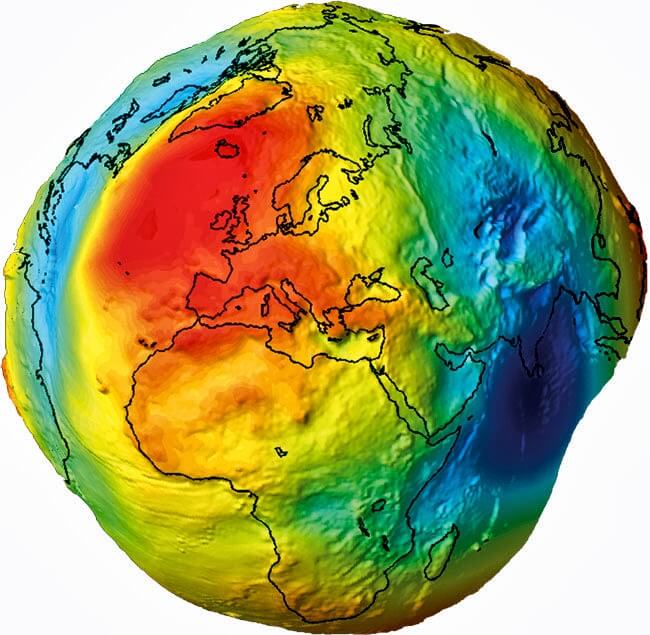
Modern gravity space missions (Gravity Recovery and Climate Experiment, GRACE, Gravity Recovery and Climate Experiment Follow-On, GRACE-FO, Gravity Field and Steady-State Ocean Circulation Explorer, GOCE) enable the precise modelling of the gravity field in terms of gravity potential, gravity anomalies and the geoid and its variations with time. Indeed, the GRACE and GRACE-FO missions are designed to monitor changes of the Earth’s gravity field induced by solid Earth processes and mass transport within the System Earth at spatial resolutions less than 500 km and with amplitudes in the order of one centimeter equivalent water height.
Sea Level & Atmospheric Observation
Modern satellite altimetry missions (such as Topex/Poseidon, Jason 1, 2 and 3; Envisat, Sentinel 3A and 3B, etc.) combined with precise satellite orbit determination and precise geoid models provided by Geodesy make the monitoring of the sea surface variations with high spatial and temporal resolutions possible. Similar satellites (like Cryosat-2) are dedicated to detect variations in the continental and marine ice cover.
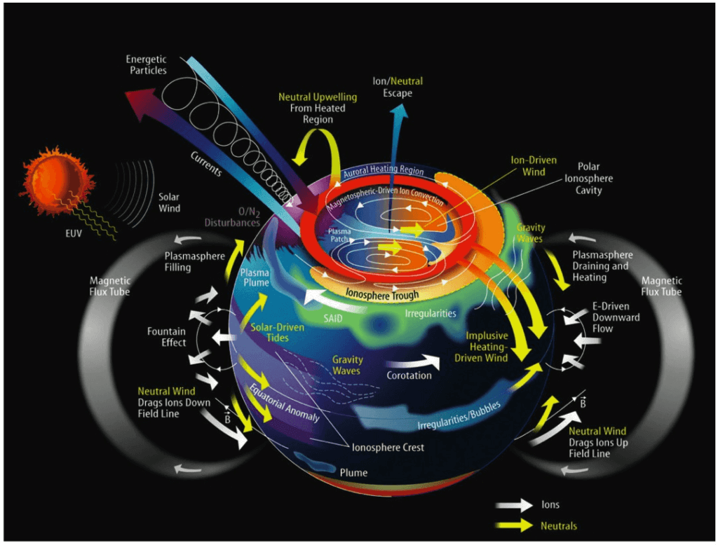
The present space geodetic techniques and methods also enable auxiliary applications that utilize the atmospheric disturbance of geodetic measurements (ionosphere, troposphere, magnetic field) for non-geodetic applications. Atmospheric disturbance was once the natural factor limiting the accuracy of geodetic measurements. Now this noise is treated as a highly informative signal, and the distortions of geodetic microwave signals propagating through the atmosphere can be inverted and employed for weather prediction, climate studies, and research in atmospheric physics and space weather.
Novel applications – especially regarding unseen benefits – are being identified on a regular basis thanks to the open geodetic data and analysis products provided by IAG technical services and GGOS.
Geodetic Earth observations based on space-based techniques are complemented and extended by terrestrial methods (in-situ observations) to measure and improve the modelling of short wavelength signals not detected by satellites; for instance, surface gravity data (terrestrial, airborne and marine gravity data) are essential to determine gravity field signals with resolutions less than 100 km. In the same way, tide gauge records are essential to improve the monitoring of the sea level in coastal areas, where the satellite altimetry techniques are not as accurate as in the open oceans.
Changes in the Earth’s size, shape, gravity field and orientation are inherently related to the Earth’s dynamics and to mass and energy transport throughout the System Earth. As the System Earth is a unique entity, any change within the System influences any geodetic observation. Consequently, to reach its primary goal of determining the time-dependent geometry, gravity field and rotation of the Earth, Geodesy is essential to the detection and appropriate handling of the signals emitted by the System Earth. Geodesy measures these signals with different sensors, in different domains, and in different time and space resolutions – providing a unique framework for monitoring and understanding the System Earth as whole, including its solid, fluid, and gaseous components.
Global Geodetic Observing System
The Global Geodetic Observing System (GGOS) is the contribution of Geodesy to Earth observations. GGOS aims to provide consistent and openly available observations of the spatial and temporal changes of the shape and gravity field of the Earth, as well as the temporal variations of the Earth’s rotation. This means delivering a global picture of the surface kinematics of our planet, including the ocean, ice cover, continental water, and land surfaces, and delivering estimates of mass anomalies, mass transport, and mass exchange in the System Earth. Surface kinematics and mass transport together are the key to global mass balance determination, and are an important contribution to understanding the energy budget of our planet.

