GGOS Focus Area
Geodetic Space Weather Research – GSWR
Introduction
Space weather means today an independent, very up-to-date and interdisciplinary field of research. It describes physical processes in space mainly caused by the Sun’s radiation of energy. The manifestations of space weather are multiple, for instance,
- variations of the Earth’s magnetic field,
- polar lights in the northern and southern hemisphere,
- variations of the upper atmosphere with the compartments magnetosphere, ionosphere and thermosphere (MIT system) (due to coupling processes),
- solar wind, i.e. the permanent emission of electrons and photons,
- interplanetary magnetic field,
- electric currents.
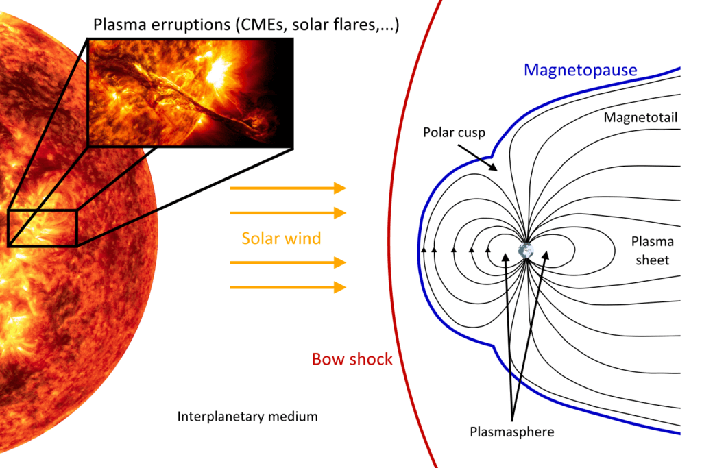
The interplanetary magnetic field (IMF) is the component of the solar magnetic field that is dragged out from the solar corona by the solar wind flow (see Fig. 1).

Michael Schmidt
E. Forootan
Vice-Chair of FA GSWR
(Denmark)
Figure 1: Scheme for the interaction of the Sun as ionization source and the Earth’s magnetic field, inspired by ESA; for details see Limberger (PhD thesis, TUM, 2015)
The most extreme known space weather event happened at September 1, 1859 – the Carrington event: a solar coronal mass ejection (CME) hit the Earth’s magnetosphere and induced the largest registered geomagnetic storm. Other prominent recent, but much weaker events have been the Halloween storm at October 28 – 30, 2003, or the St. Patrick’s storm at March 17, 2015. The strength of these events, their impacts on modern society and the possibility of much stronger future events have brought several countries such as US, UK, Japan, Canada and China to recognize the necessity of studying these impacts scientifically, of developing protection strategies and procedures and to establish space weather data centers and space weather services. As a consequence of these activities the Focus Area on Geodetic Space Weather Research (FA-GSWR) was initiated. The following statements summarize the necessity of geodesy to cover scientific research on the coupling processes within the ionosphere and the thermosphere: Geodesy has
- to deal with the ionosphere, since the measurements of most of the space-geodetic observation techniques are depending on the properties of the ionosphere along the ray path of an electromagnetic wave between transmitter and receiver,
- to deal with the thermosphere, since the thermospheric drag is the most important deceleration effect on Low-Earth Orbiting (LEO) satellites and objects in the re-entry stage,
- a long history and large experience in developing and using sophisticated analysis techniques and modelling approaches.


