GGOS
Core Sites
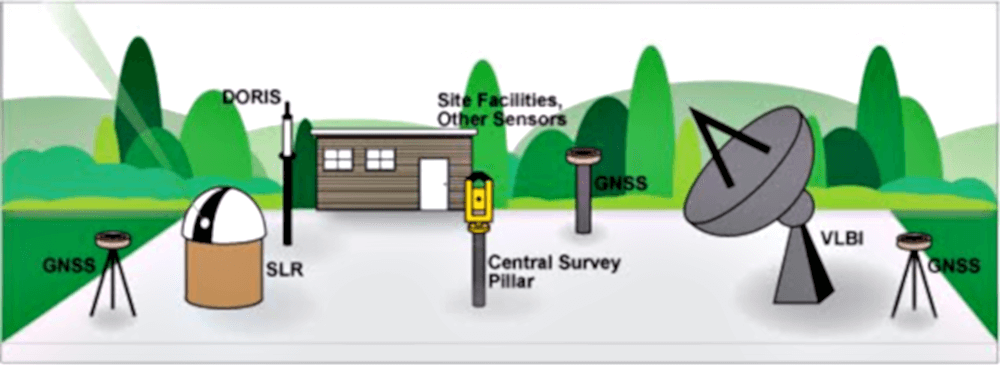
The GGOS Core Sites co-locate the major observation techniques and a variety of additional sensors and instruments (e.g. meteorological sensors, water vapour radiometers, etc.). The co-location of the different techniques allows not only the integration of individual technique-specific networks into a unique terrestrial reference frame but also to the assessment of the observation quality and accuracy as well as the mutual validation of the results. The integration of the individual technique-specific networks is coordinated by the IERS.
![]() active
active ![]() in progress
in progress
Co-located Instruments / Technologies:
Co-location at Ishioka Site (Japan) between VLBI and GNSS to determine the local-tie vector:
Space Domain (geodetic techniques):
- GNSS – Global Navigation Satellite Systems
- SLR – Satellite Laser Ranging
- VLBI – Very Long Baseline Interferometry
- DORIS – Doppler Orbitography and Radiopositioning Integrated by Satellite
Time Domain (highly-stable frequency standards):
- Cesium standards
- Hydrogen-maser
Earth Gravity:
- Absolute Gravimeters (AG)
- Superconducting Gravimeters (SG)


