PSMSL – Permanent Service for Mean Sea Level
Development
Since 1933, the Permanent Service for Mean Sea Level (PSMSL) has been responsible for the collection, publication, analysis and interpretation of sea level data from the global network of tide gauges. It is based at the National Oceanography Centre (NOC) in Liverpool, UK. The PSMSL continues to be one of the main data centres for both the International Association of Geodesy (IAG) and the International Association for Physical Sciences of the Oceans (IAPSO). The PSMSL operates under the auspices of the International Science Council (ISC) and reports formally to IAPSO’s Commission on Mean Sea Level and Tides. The PSMSL is a regular member of the World Data System of ISC.
Mission/Objectives
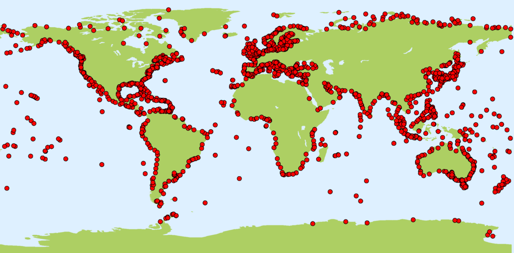
The primary purpose of the PSMSL is to grow the databank and fill in gaps in the observational network, incorporating novel techniques (e.g. automatic QC) and technologies (e.g. Global Navigation Satellite System (GNSS) Interferometric Reflectometry). The main PSMSL data set consists of monthly and annual means of sea level from over 2000 stations around the world, making up over 72,000 station-years of information. These data are used within a wide range of geosciences, of which studies of sea level rise in assessments such as those of the Intergovernmental Panel on Climate Change (IPCC) are the most highly-cited. The maintenance of this data set requires communication with agencies in almost every country in the world with a coastline.
PSMSL report at the GGOS Days 2023
The PSMSL plays a major role in network building and works closely with the Intergovernmental Oceanographic Commission (IOC) in the construction of the Global Sea Level Observing System (GLOSS). An important component of that work relates to capacity building, and the PSMSL has organized or been heavily involved in the organization of training courses over the last 30 years. In addition, it has worked with the IOC and other agencies to advise and assist with the installation of new stations in Africa, the Caribbean, and other data sparse areas.
Networks
While the main PSMSL data set is composed of monthly and annual mean values of sea level, it works closely with the British Oceanographic Data Centre (BODC), the University of Hawaii Sea Level Centre (UHSLC) and the Flanders Marine Institute (VLIZ) to provide records of ‘high-frequency’ (<= hourly values) sea level data for use in studies of tides and extreme water levels. The appropriate links may be found on its web site.
The PSMSL works closely with other IAG-related Services, especially the IGS and IDS with regard to the measurement of vertical land movements at tide gauges. The PSMSL has been working in collaboration with colleagues at SONEL, the GLOSS data centre for GNSS measurements, to make it easier to connect the PSMSL data with SONEL’s GNSS data. SONEL also maintains a catalogue of DORIS beacons co-located with tide gauges.
Publications
Formal reviews of the work of the PSMSL are available (Woodworth and Player, 2003; Holgate et al., 2011). However, the PSMSL has also recently put major effort into improving the delivery from its web site (www.psmsl.org) of a wide range of data, derived products, and background and training information.
1. (a) Stations represented in the data set of the Permanent Service for Mean Sea Level (PSMSL)
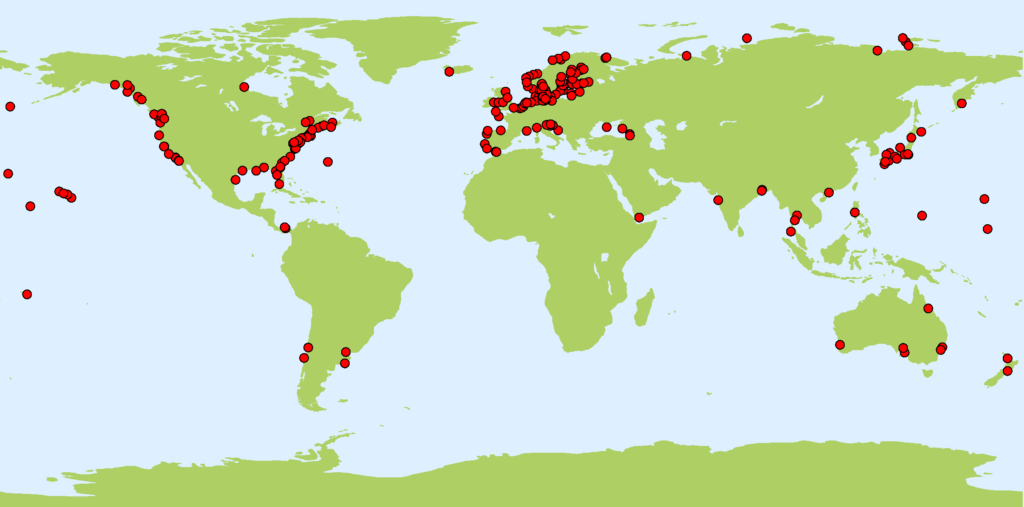
1. (b) Stations with long records containing more than 60 years of data
References
Holgate, S.J. et al. 2011. New Data Systems and Products at the Permanent Service for Mean Sea Level. (In preparation).
Woodworth, P.L. and Player, R. 2003. The Permanent Service for Mean Sea Level: an update to the 21st century. Journal of Coastal Research, 19, 287-295.
Content of this contribution provided by Phil Woodworth and updated by Elizabeth Bradshaw and Andy Matthews (2020)
(last update 09.2020)


