GGOS
  • About
    • About GGOS
      • What is GGOS?
      • Why GGOS?
      • Dual Roles of GGOS
      • Vision and Mission
      • GGOS History
      • Organization Structure
        • Managing Body
        • Coordinating Office CO
        • Science Panel
        • Bureaus
        • Focus Areas
        • GGOS Affiliates
        • GGOS Committees & Working Groups
  • Observations
  • Services
    • Geometric & General Services
      • IGS – Int. GNSS Service
      • ILRS – Int. Laser Ranging Service
      • IVS – Int. VLBI Service
      • IDS – Int. DORIS Service
      • IERS – Int. Earth Rotation and Reference Systems Service
      • PSMSL – Permanent Service for Mean Sea Level
    • Gravity Services
      • IGFS – Int. Gravity Field Service
      • ICGEM – International Centre for Global Earth Models
      • IDEMS – International Digital Elevation Model Service
      • IGETS – International Geodynamics and Earth Tide Service
      • ISG – International Service for the Geoid
      • BGI – International Gravimetric Bureau
  • Products
  • Events
    • Events
      • Upcoming Events
      • Past Events
      • Calendar
  • Blog
    • GGOS Blog – News
      • News
      • Article
      • Introduction
    • Newsletter
    • GGOS Cloud
    • Terms of References and Strategy
    • Reports and Articles
    • Presentations and Poster
    • Graphics and Images
  • Search
  • Menu Menu
  • Twitter
  • Youtube
  • LinkedIn
  • Facebook
  • GGOS Newsletter
  • Email - Contact GGOS
  • ABOUT
    • What is GGOS?
    • Why GGOS?
    • Dual Roles of GGOS
    • Vision and Mission
    • GGOS History
  • ORGANIZATION
    • Structure Overview
    • Managing Body
      • Overview
      • Executive Committee EC
      • Coordinating Board CB
      • Consortium
    • Coordinating Office CO
    • Bureaus
      • Overview
      • BNO – Bureau of Networks and Observations
      • BPS – Bureau of Products and Standards
    • Focus Areas
      • Overview
      • Unified Height System
        • Introduction
        • Presentation
        • Objectives
        • Activities
        • Working Groups
        • Further Reading
      • Geohazards
      • Geodetic Space Weather Research
        • Introduction
        • Objectives
        • Study and Working Groups
    • GGOS Affiliates
      • Overview
      • GGOS Japan
    • GGOS Committees & Working Groups
    • Science Panel
  • OBSERVATIONS
  • PRODUCTS
  • SERVICES
  • EVENTS
    • Upcoming Events
    • Past Events
    • Calendar
  • BLOG – News
  • GGOS DOCUMENTS
    • GGOS Cloud
    • Terms of References and Strategy
    • Reports and Articles
    • Presentations and Poster
    • Graphics and Images

SURVEY

More information


Geodetic Data Availability and Visibility

In your experience, is it easy to find geodetic data and products? *
Where would you mainly start to search for geodetic data or products? *
Do you agree that a central point of access for geodetic data and products is missing to improve discoverability and should be established in the future GGOS-Portal? *

GGOS Portal Functionalities - Part 1

What would be a great benefit of a future GGOS-Portal?

Please rate for each of the following statements (agree, partly agree, don't agree, N/A):

Have a central access point for geodetic data and products. *
Get a clear overview of all available geodetic data and products. *
Geodetic data and products become more visible *
The importance of the IAG and Geodesy as a whole becomes more visible *

Which geodetic data and products should be accessible via the GGOS-Portal?

Please rate for each of the following statements (needed, desireable, nice to have, not needed, N/A):

Data from IAG components (e.g. Services). *
Other non-IAG geodetic research products derived from geodetic data. *
Data from space agencies (e.g. ESA, NASA) relevant to Geodesy. *
Densified geodetic data on a regional or national level (e.g. from mapping agencies). *

What challenges will arise in realizing the GGOS-Portal?

Please rate for each of the following statements (big challenge, challenge, small challenge, no challenge, N/A):

Make the GGOS-Portal user friendly *
Encouraging data provider to create / maintain metadata (and DOI’s) for their data and products *
Maintenance and long-term availability of the GGOS-Portal *

What functionalities should the GGOS-Portal offer?

Please rate for each of the following statements (very important, important, nice to have, not needed, N/A):

Search by spatial selection (on an interactive dynamic map) *
Search by temporal selection (setting requested time period on a timeline) *
Search by API request *
Inform users about related data/products on the search results page *
Show easy-to-understand descriptions of products & observation techniques that suits to selected data sets. *
Attractive visualization of selected geodetic data and products (e.g. by interactive graphs, charts) *
Exchangeability: GGOS Portal metadata can also be synchronized / harvested on other portals (e.g. GEOS portal) *

GGOS Portal Functionalities - Part 2

Which user groups should be addressed by the GGOS-Portal? *

How detailed should the metadata descriptions be in the GGOS-Portal? *
Do you have experiences in open source software packages for metadata portals? *

Your Interaction with Geodetic Data

How do you interact with geodetic data and products? *

Usage of Geodetic Data:

Which category best describes what you use geodetic observation data and products for? *

How often are you using geodetic data? *

Provision / Production of Geodetic Data:

Which kind of geodetic data are you producing / providing? *

Multiple selections possible

How often is your data changing or get updates? *

Metadata:

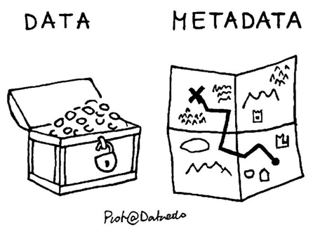
Metadata is data that provides information about the actual data, but not its content. They usually exist in a common metadata standard (schema) to make them comparable (e.g. Sitelog, GeodesyML, ISO19115, ...) and they are usually accessible via the Internet in a machine-readable format (e.g. XML, JSON), at a (S)FTP or HTTP(S) server or via an standardized interface (API).

Do you provide metadata for your geodetic data/products? *
Do you plan to create metadata for your geodetic data/products in future? *
If you still have a reliable repository (data center) for your geodetic data/product, are you interested in creating (and maintaining) metadata for them directly in the future GGOS-Portal? *

How do you make your metadata available in the Internet? *

Please specify the used standardized interface or API which you are using: *

Which metadata standard / schema do you use? *

How often do you update your metadata content? *
Are you interested in making your metadata available (synchronized) on the future GGOS-Portal? *

Digital Object Identifier (DOI):

To make geodetic data and products FAIR (Findable, Accessible, Interoperable and Reusable) it is advantageous to assign DOI (Digital Object Identifier) for them. This allows citability and scientific recognition. In addition, due to the machine readable format, DOI's can be easily included into the future GGOS-Portal.

Do your geodetic data/products have DOI's (Digital Object Identifier)? *
Are you interested in creating DOIs for your data to make it more discoverable and citable? *
Why are you not currently using DOI's for your geospatial data? *

General Questions about You

Please indicate the scientific field(s) in which you are active. *

Please select the following organizations if you are active in them?

Are you involved in the IAG (International Association of Geodesy) or its sub-components? *

Please select the affiliated IAG component(s) *

Please select your affiliated IAG Service(s) *

Please select your affiliated IAG Commission(s) *

Please select your affiliation in Commission 1 *

Please select your affiliation in Commission 2 *

Please select your affiliation in Commission 3 *

Please select your affiliation in Commission 4 *

Please select your affiliated ICC (Inter-Commission Committee) *

Please select your affiliation in IAG Project "QuGe" *

Please select your affiliation in GGOS *

Are you involved in another Association of the IUGG (International Union of Geodesy and Geophysics)? *

Please select your IUGG Association *

Personal Questions:

Please answer the following optional questions so that we can contact you later on.

Further Comments:

Save as Draft


GGOS is a part of the IAG and the IUGG

Contact Us

Email to GGOS

Follow Us

Twitter

YouTube

Linked In

Facebook

GGOS Newsletter

RSS Feed

Interesting Pages

GGOS Blog – News

Documents of GGOS

Internal Links

GGOS Cloud

Webmail

Admin Area

References

Terms of Use (Website)

GGOS Terms of References

GGOS Strategic Plan


2023 © Copyright - GGOS Global Geodetic Observing System
  • Twitter
  • Youtube
  • LinkedIn
  • Facebook
  • GGOS Newsletter
  • Email - Contact GGOS
Scroll to top